£395.00 – £545.00 ex VAT
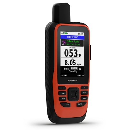
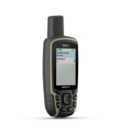
Garmin Montana 700 series of GPSs are excellent, high end, all-round, rugged, efficient, and accurate navigation units. They provide you with a high-sensitivity receiver which uses multiband technology to connect to numerous satellite networks. Enabling quick and accurate location and bearings. The unit is IPX7-rated waterproof. Features a generous 5-inch colour screen that can be viewed in sunlight and has an impressive 16GB of memory for data storage. Such as updates, routes, map markers, geocaches, and more. This can be further upgraded with the addition of (at max) 32GB microSD card. The 700 series model also provides users with a 3-axis tilt compass for accurate and easy navigation, a must-have in challenging environments. As well as a barometer providing you with current weather conditions and an altimeter which lets you know your current height above sea level. All of these are within a comfortable-to-use, hand-held navigation unit.
Garmin Montana 700 GPS is essentially, the perfect all-round, field and vehicle GPS navigation unit. It boasts an incredible amount of features that allow you to use it as a satnav system and field GPS. Such as routable topographic maps, a touch screen, a compass, a barometer, an altimeter, satellite imagery, and much more. Due to the diversity of this unit, it lends itself especially well to exploration geologists, undertaking geological mapping and mineral surveys. Even in the most remote of areas.
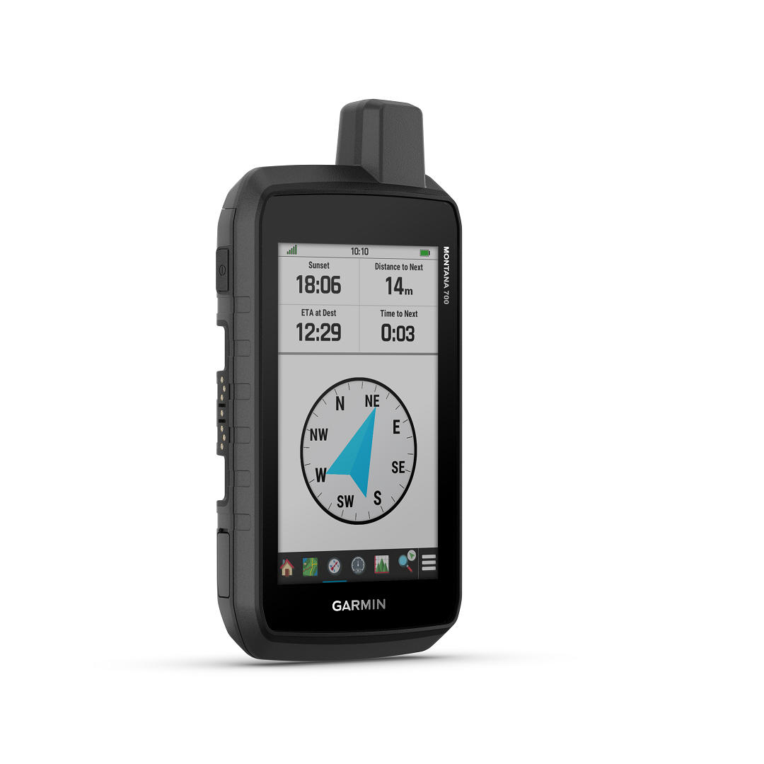
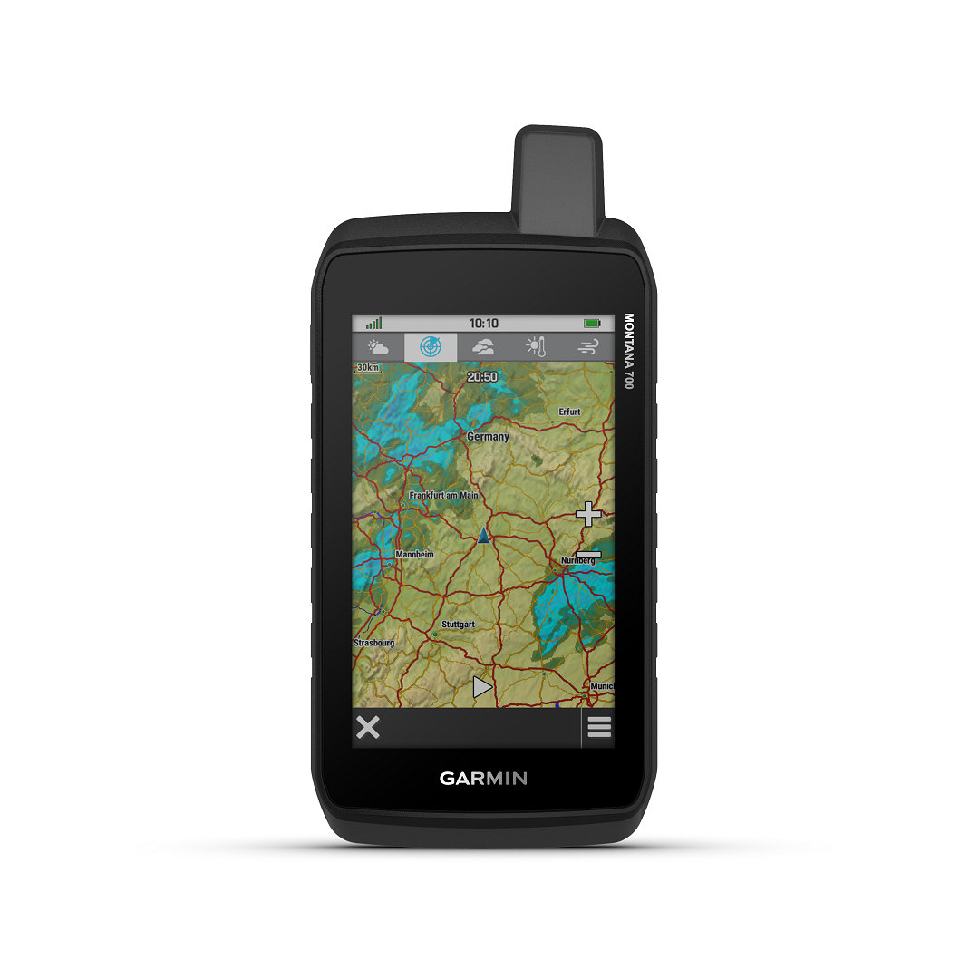
Right out of the box, this Montana 700GPS displays a large, 5-inch color touch screen featuring WVGA transflective backing and dual orientation. Particularly useful if you wish to switch from field use to satnav mode quickly. It comes as standard with routable mapping for roads and trails, that’s ideal for navigation on foot, pickups, ATV’s and more. Satellite imagery also allows for a clear overlay of such over your viewing area, bringing up the details which you will otherwise not be able to see. Furthermore, the 700 series also comes with a 3-axis tilt compass for navigation and bearings on the go. This is in addition to a barometer for relaying back to you, weather conditions, and an altimeter for informing you of your current altitude.
With the inclusion of topo maps from Europe, with the option to purchase top maps for other regions and countries. You can easily navigate your way around road networks, where ever you are. These can be loaded thanks to the adequate 16GB of memory space available. However, you may also increase this by up to 32GB max, with the addition of a microSC card if you wish. The standard memory allows for the storage of thousands of map segments, points of interest, waypoints, tracks, logs, routes, and more.
Thanks to its high sensitivity receiver with multichannel capabilities. The 700 series obtains its navigation and location data from a number of satellite networks. Those being: GPS, GLONASS, and GALILEO. Ensuring you are not without crucial data as and when you need it.
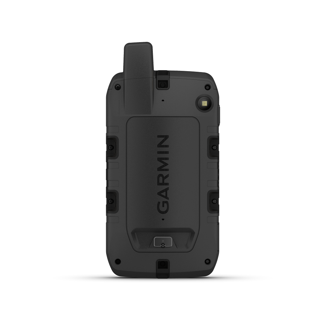
The Garmin Montana 700 GPS is a series comprised of three models. The 700, 700i and 750i. The 700 features all of the basic functions as described plus more. The 700i, like the 700 features the same, but also comes with the addition of Garmins, inReach technology. With a subscription to the service. (See, HERE for further details). You can send and receive text messages either to other phones or other GPS users with a compatible model. Exchange data and details between units. Send and receive waypoints, set up routes, and plan maps. Additionally, you can trigger an SOS signal, depending on your area, which will notify the nearest rescue teams to assist and come to your aid. This is all processed through the Iridium satellite network. The 750i version features all of the same as the 700i, but has the addition of an 8MP camera. This can be a benefit to both trekking enthusiasts and professionals who work in the field. The ability to take photos on the device and also have them connected to a specific location is beneficial. As you can photograph particular landmarks for navigation purposes or in the case of exploration geology, an outcrop of sampling site that has yielded results or samples of interest for further investigation at a later date. The process is automatic, with geotagging photos with coordinates proving useful later.
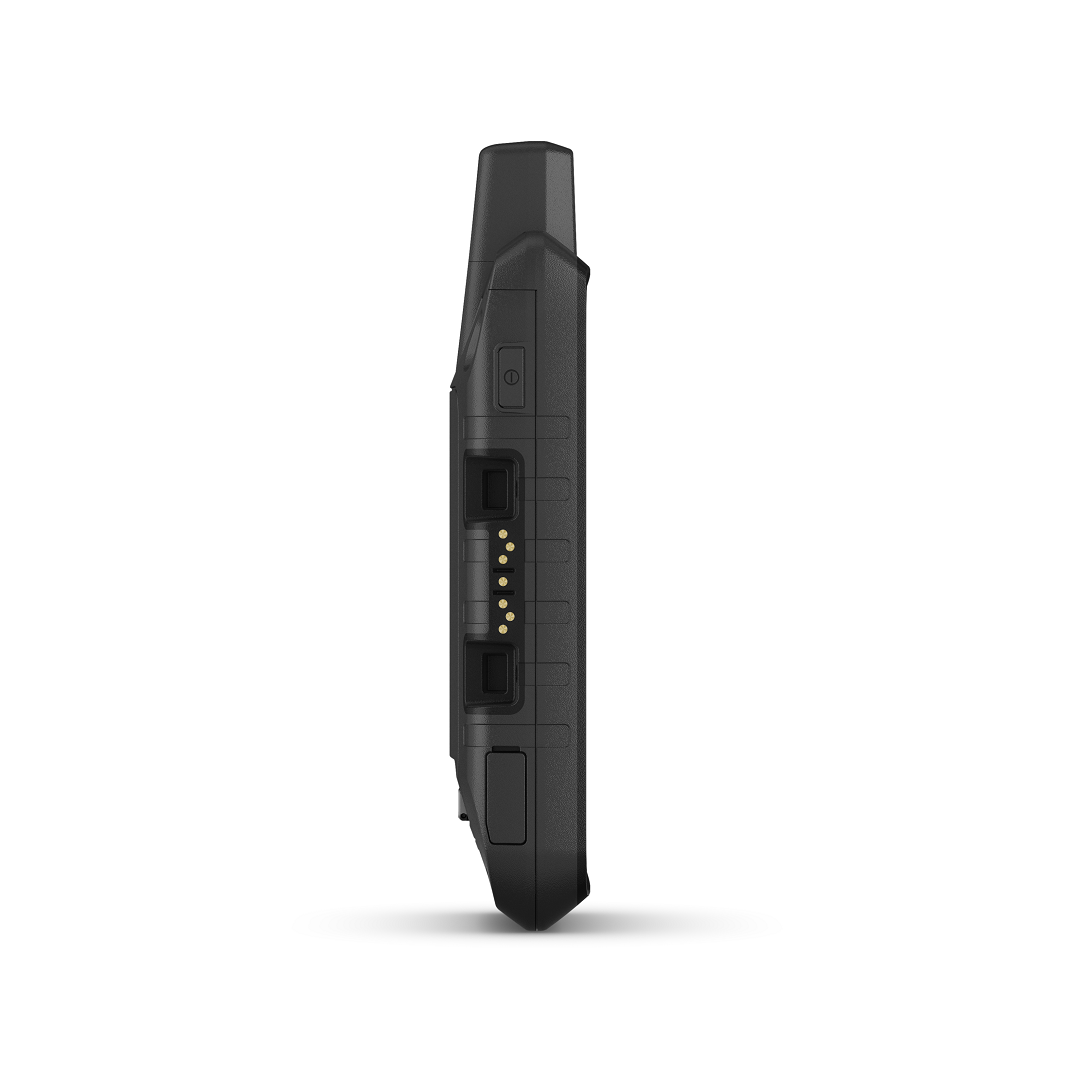
Upon opening the Montana 700 or its variant models. You will immediately notice a generous, 5-inch color screen. Allowing you to view the display without sun glare and in portrait or landscape modes. Measuring 8.76 x 18.30 x 3.27 cm in size and weighing less than 400 grams. You will notice how comfortably the unit rests in your hands, but also, how lightweight it is for its size. It is not cumbersome to carry or use in the field and sits nicely on your vehicle dash or other placement, without obstructing your view too much. All of its technical features are powered by a removable, rechargeable lithium-ion battery. This allows you to operate the device for up to 18 hours in GPS Mode or 330 hours when in Expedition Mode. Activation of other features will affect the battery life. The case is extremely rugged, with IPX7, able to withstand submersion in up to 1 meter of water for 30 minutes. This in addition to MIL-STD-810 making it thermal and shock proof.
You can transfer data via the built in Wi-Fi®, Bluetooth® and ANT® functions. Further it features a High speed micro USB connection and is also NMEA 0183 compatible. If you’re looking to undertake a survey or field project, these allow for transfer and back of your collected data.
The Montana 700 series of GPSs are extremely versatile, they offer users a multitude of features. Which, for those of you in the more remote areas, should not be without. It’s versatile nature of providing you with both a field GPS unit as well as a satnav makes them an excellent addition to any field geologists kit. Especially those of you undertaking work in remote areas. Choosing the 750i also enables geotagging on any field photos you take, for quick and easy referencing in your field report or for geological sampling. Furthermore, it’s robust nature means they will put up with what ever you throw at them in the field and still come out on top, with all of your critical data intact.