£430.00 ex VAT
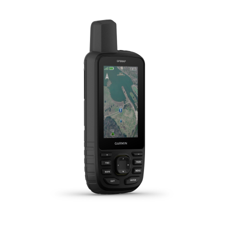
The Garmin GPSMAP 86i gives users all of the features of the 66 series, as well as the compatibility with Garmins inReach network. Providing connectivity in case of emergencies and the ability to text, SMS, email, or even give an SOS signal. As standard, the unit is easy to view thanks to a wide 3-inch colour screen which can even be seen in the glaring sun. The high-sensitivity receiver connects to both the GPS and GALILEO networks, providing you with fast and accurate grid references. Furthermore, the 86i comes with a barometric altimeter and 3 axis tilt compass for orientation and navigation. The hefty 16GB of memory allows for the storage of thousands of routes, satellite imagery and maps, waypoints, tracks, points of interest and more.
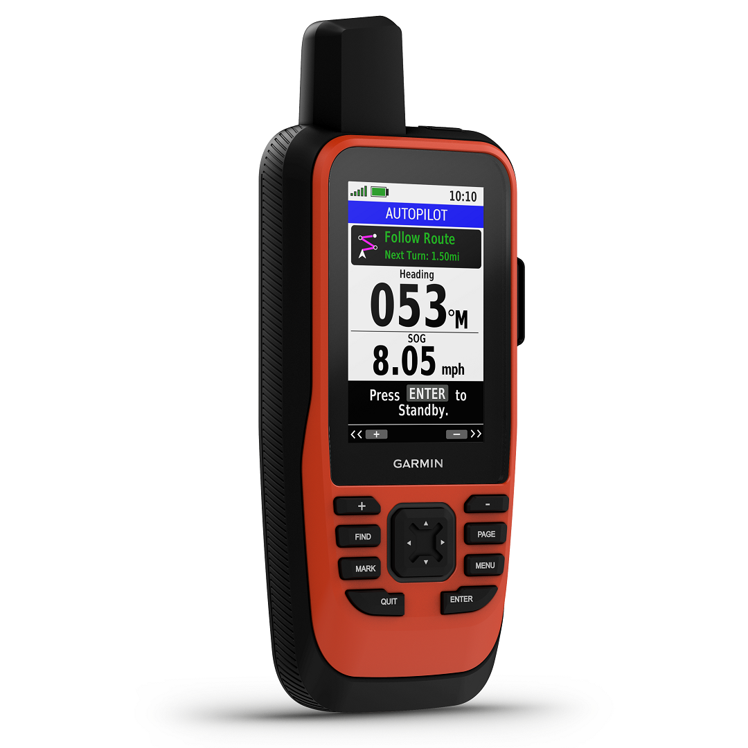
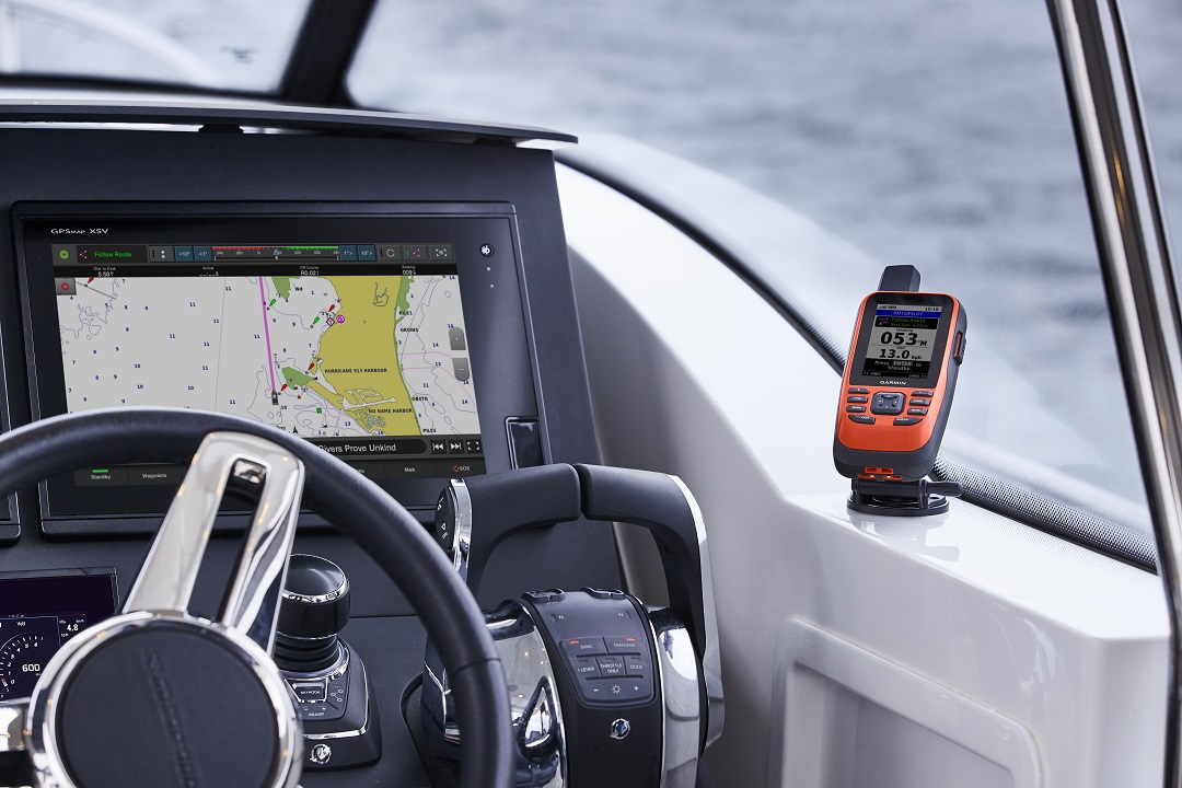
As for marine use, the navigation unit can sync up to most marine onboard systems, aiding with autopilot, navigation, marine routes, and conditions. You can also utilise the hunting and fishing season function if required. Data can be transferred wirelessly or via USB cables, enabling a back up of important information.
In addition, you can expect a long day, up to 35 hours of battery life in 10-minute tracking mode. In expedition mode, this can be boosted to 200 hours. You will never be left out of touch. To top it off, this unit also comes with two USB cables, a powered mount, and mounting hardware to secure the unit in place.
Approx 1 Week Delivery Time on this Unit.
The Garmin GPSMAP 86i boasts all of the excellent features and global communications of the GPSMAP66 series. But also has the addition of on-the-water features for marine and boating use. This includes wireless connectivity to your onboard marine system.
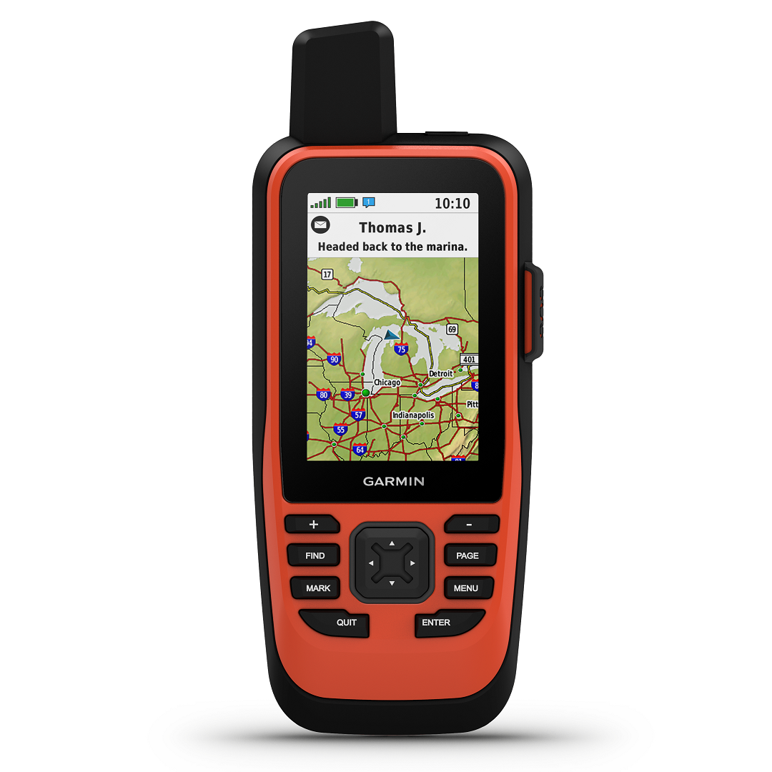
The 86i runs Garmins most up-to-date platforms and programs. Featuring an accurate GPS reading, (while moving), a tilt-compensated 3-axis compass and a barometric altimeter. These main features will provide outdoor users with accurate and up to navigation, bearing, and height information. Further to this, other standard additions include an active weather display, sun and moon data, the ability to view satellite imagery direct to the unit, and storage of multiple routes and waypoints. You can also send it to MapShare if you wish.
It also allows you to wirelessly connect to other devices, using Wi-Fi, Bluetooth, or ANT+. Signing up for Garmins other services, such as ‘Garmin Express’ will also allow you to search for points of interest, such as parks, campgrounds, lookouts, and so on.
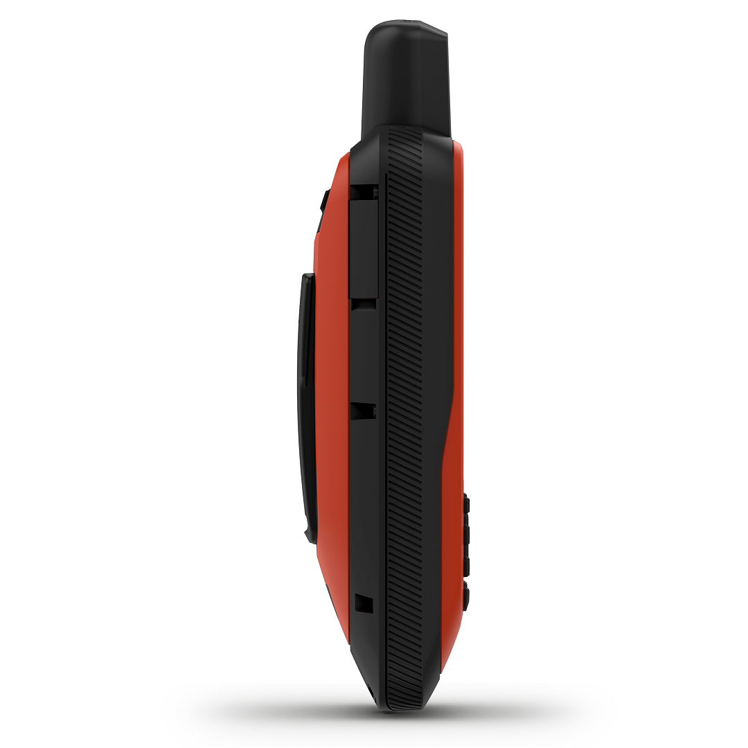
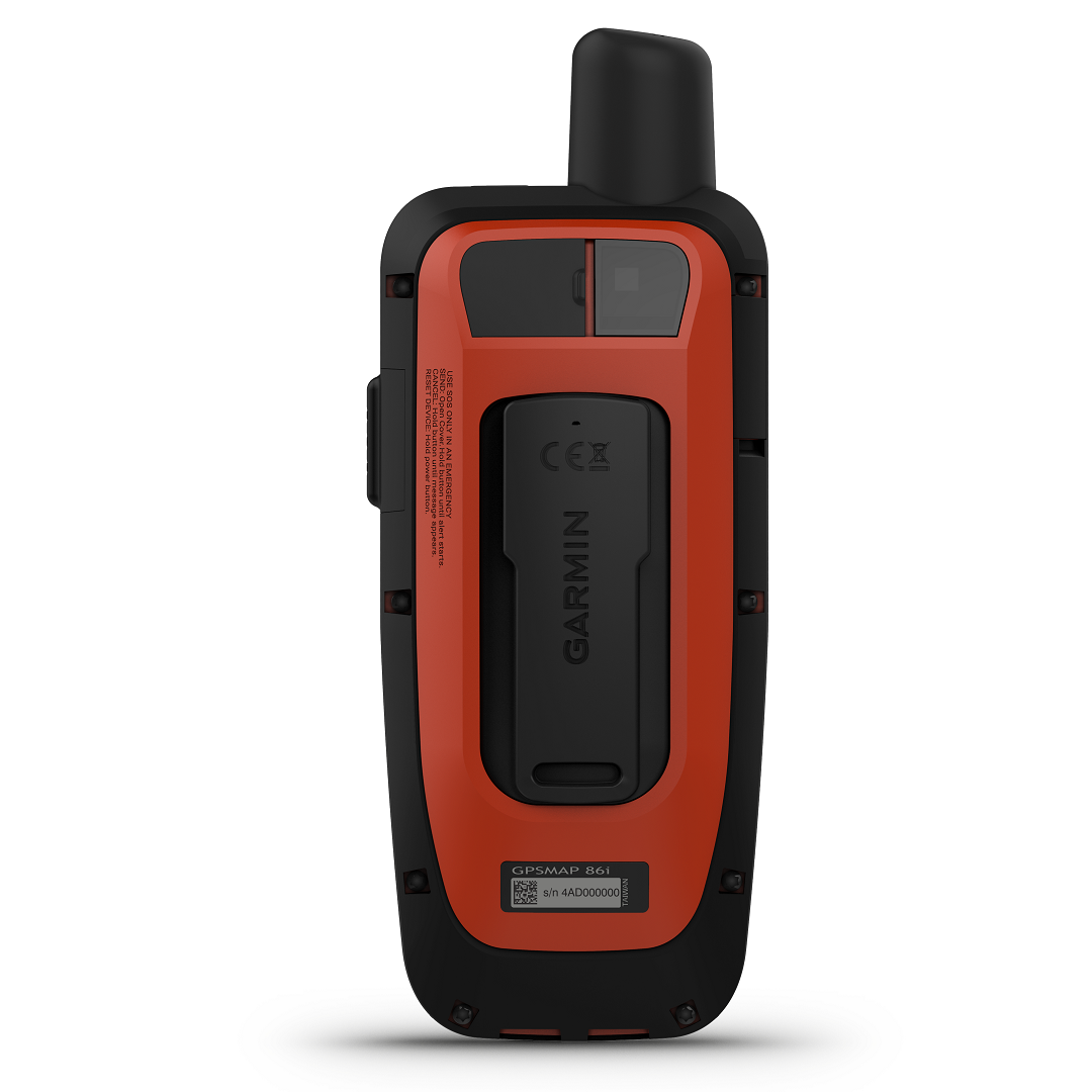
Viewing the screen on the Garmin GPSMAP 86i will be easy, thanks to its generous 3-inch TFT colour screen. This is also transflective, therefore being easily visible even in glaring sunlight. The resolution offered is 240 x 400 pixels for clear imagery, icons, and text. Its ergonomic design ensures the device rests comfortably in your hands, coming in at only 272 grams and measuring 17.8 x 4.4 x 7 cm in size.
You can also rest easy when it comes to battery life, as you can get up to 35 hours out of it in 10 minutes tracking mode. However, in expedition mode, you can look forward to 200 hours of use.
As standard, you can store 10000 waypoints, features or locations, base maps, 250 navigation routes, 20,000 tracking logs, geocaching friendly and more. Thanks to the 16 GB memory supplies. This can be expanded if you wish by installation of a microSD card, (not supplied). Data can also be transferred, if not wirelessly, then by the USB cables supplied.
Using its high-sensitivity receiver, the GPSMAP 86i uses both the GPS and GALILEO satellite networks to obtain your position. No matter where you are.
The GPSMAP 86i is compatible with Garmins inReach network and offers a number of other benefits to the user. Particularly in the areas of safety. The device is inReach remote compatible, able to send and receive text messages via SMS and email. Exchange locations with other devices using inReach. Furthermore, this allows you to use an interactive SOS feature as well, should you require emergency assistance.
The GPSMAP 86i is suitable for use by those working on the water. The case is rated to IPX7 for being waterproof. Plus, the device also floats, making collection easy. You can also view all of your marine systems infor at a glance with boat data streaming. It can also interact with and control your autopilot and Fusion systems. Also able to sync with chart plotters, provide accurate marine tracking and as standard. Comes with a worldwide base map. You may also wish to purchase the option ‘BlueChart g3’ coastal charts for details navionic data.
In the box, you get the handheld unit which also includes a worldwide base map. However, that’s not all. You also get a powered mount, lanyard, and mounting hardware for affixing to your boat’s panel or vehicle dashboard. Making viewing on the go, easy. Furthermore, you are providing a USB to micro USB cable, USB to 2 pin cable, and your necessary documentation.